Tribal warriors led by Mihšihkinaahkwa (Little Turtle) of the Miami and Weyapiersenwah (Blue Jacket) of the Shawnee led the defeat of the American Army at St. Clair’s. The American army lost approximately 1,000 men, the largest defeat between tribal forces and the American Army.
Between 1774 and 1794, Indian villages in New York, Pennsylvania, Indiana, and Ohio were constantly attacked by the American army and militias. The native Americans saw 100 villages burned and untold violence and casualties.
The Battle of Fallen Timbers (20 August 1794) was the final battle of the Northwest Indian War, a struggle between Western Confederacy of Native American tribes with the British, fighting against the newly formed United States. This was the battle for control of the Northwest Territory, of which present-day Indiana was a part.
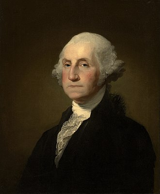
George Washington (February 22, 1732– December 14, 1799) served as the first president of the United States from 1789 to 1797. As a General Washington, he led Patriot forces to victory in the Revolutionary War. In 1787, he presided at the Constitutional Convention which established the U.S. Constitution and a federal government.
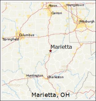
Governor Arthur St. Clair arrived within the Northwest Territory at Marietta, Ohio to begin administration of civil duties within the territory. St. Clair formally established the territorial government on July 15, 1788. The settlement of Losantiville was renamed by St. Clair to “Cincinnati” in 1790 and he moved the administrative and military center of the territory to Fort Washington.
Fort Washington was in downtown Cincinnati, providing easy access to the Ohio River. The Fort was the major staging area for settlers, troops and supplies during the settlement of the Northwest Territory.
The first written criminal and civil laws of the Northwest Territory were established. Thirty-seven different laws were written with the understanding that the laws had to have been passed previously in one of the thirteen original states. A structured court system was established.
Many early trips west began in Marietta or Cincinnati. The first part of Indiana to be settled was in the south and southwest, along the rivers.
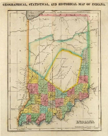
Marietta is on the Ohio River Between Pittsburgh and Cincinnati1822 Map of Indiana
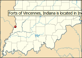
The settlement of Indiana happened primarily from the rivers. The south and southwestern parts of Indiana were divided into counties first. Fort Vincennes was established by the French between 1731-1732. The Fort was later was occupied by the British who called it Sackville before it became a possession of the U.S.
Vincennes was used to muster soldiers to fight in the Battle of Tippecanoe in 1811. The soldiers marched along the Wabash to near the confluence of the Tippecanoe and Wabash Rivers. The area is known today as Battle Ground, Indiana. It was there that General William Henry Harrison met the confederacy of tribes led by Tenskwatawa, “The Prophet” for battle. Tenskwatawa was the brother of the great Shawnee warrior, Tecumseh, who was not at the battle.
Vincennes was the first capital of Indiana Territory until it was moved to Corydon on May 1, 1813.
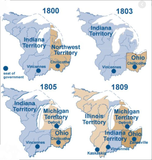
The Northwest Territory was established by the Northwest Ordinance on lands that that later became Indiana, Ohio, Illinois, Michigan, Wisconsin and part of Minnesota. The territory marked the the nation’s first post-colonial organized territory. The territory ceased to exist on March 1, 1803 when other territories were made from the land it contained.
At first, the land in the Territory was absorbed first into Indiana Territory and Ohio. Indiana territory was much larger than the state of Indiana today. Indiana Territory existed from July 4, 1800, to December 11, 1816, ending when Indiana became a state.
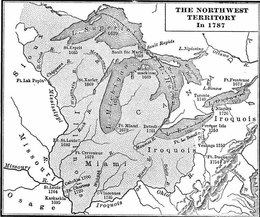
Map of the Northwest Territory 1787
Book: Charles Kendall Adams, A History of the United States (Boston, MA: Allyn and Bacon, 1909) pg 189; Map Credit: Courtesy the private collection of Roy Winkelman
History of the Northwest Territory Divisions
Map Courtesy of: Indiana History Blog, (blog.history.in.gov)
The Treaty of Paris was signed with the British ending the Revolutionary War.
The Spanish, along with American citizens, marched into Western Quebec (what later became the Northwest Territory, which included Indiana), and expelled the British forces. Sir Henry Clinton lead forces that forced British General Cornwallis to retreat to Yorktown, Virginia. Cornwallis surrendered in October 1781.
On September 3, 1783, the treaty was signed between Great Britain and the United States which officially ended the war.
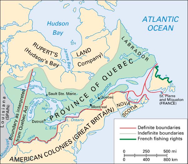
Below: In 1774, Indiana was part of the Province of Quebec. In 1883, present-day Indiana was ceded by the British to the United States.
George Rogers Clarkmarched a militia of mostly sympathetic Canadian volunteers through present day Ohio and Indiana to Illinois in 1778. Clark won what became the Northwest Territory for the patriots with the Siege of Fort Vincennes (also known as the Siege of Fort Sackville or the Battle of Vincennes) to help end the U.S. Revolutionary War.
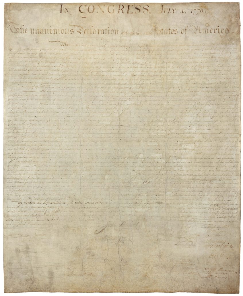
The British Colonies in North American (present-day United States) declared their freedom from British rule. The Declaration of Independence expresses the ideals on which the United States was founded and the reasons for separation from Great Britain.
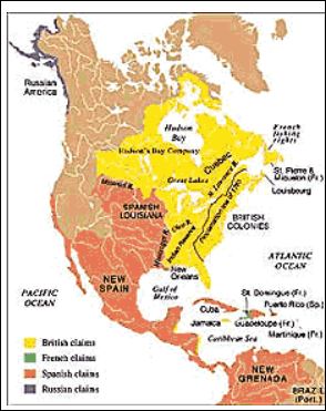
The British took possession of the area that included what would become the Northwest Territory from the French. In the Royal Proclamation of 1763, Britain forbid American colonists from settling in the “New West”, which included present-day Indiana. The British allowed a few hundred Frenchmen who were already settled in the area to remain but the colonists were restricted from crossing the Appalachian Mountains to settle. The British had set aside this land in treaties with Native Americans.
As crowding and competition increased, the prohibition put stress on the European settlers and contributed to the American rebellion and revolution. The line was just west of Appalachia and is referred to as the Proclamation Line.
1763 France Ceded Land to Great Britain. Proclamation line west of Appalachian Mountains.
The French and Indian War (7-Years-War) was part of the larger struggle between the French and the English. At the end of the war, French forts were occupied by the British. The land that was Indiana was among the lands ceded to Britain by France.