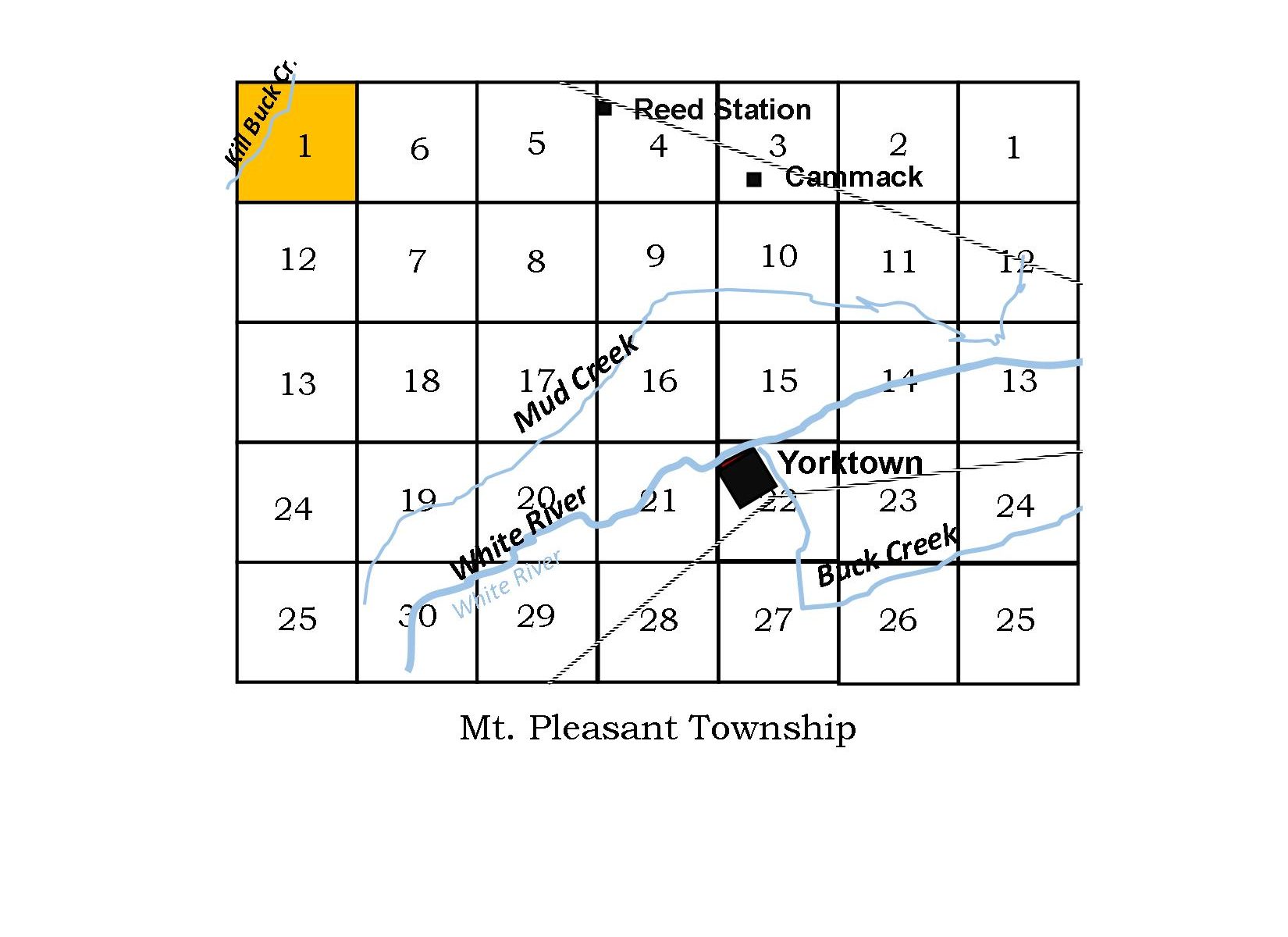
Section 1, Township 20 (Range 8) northwest side of the township The confluence of Killbuck Creek and Pleasant Run are nearly in the center of this section. As discussed above, the surveyed township sections do not correspond with the civil administration, making two section 1’s in Mt. Pleasant Township. Next newsletter we will look at Section 1, Township 20 on the northeastern part of the township. In 1898, John S. Ellis says “the section has a free gravel pike along the north line, and public roads on the west, through the center and a portion of the south line. This section joins Harrison township on the north and Madison County on the west.” Section 1 (Range 8) was first purchased by John Nelson Groenendyke (Gronendyke, Groenendike, Groenendijck) in 25 May 1832 with his wife, Elizabeth Smelser, 1807-1898. John was a resident of Fayette County, Indiana as early as 1830. He died in Fayette County in 1886. Thirty acres of the land in Section 1 were sold to his brother, James Groenendyke, and James’ wife Charity Durman in 1840. John Nelson Groenendyke (1802-1886) and brother, James Groenendyke, Jr. (1812-1871), were two of the 15 children of James Groenendyke, Sr (1770-1836). John Sr. first married Johanna Antonidis and later, after her death, he married Barbara Buck. Johanna is the mother of these two sons. Their family line goes back to Holland, with Pieter (1645-1699) immigrating to “New Amsterdam” (New York) sometime before 1673. They were a Quaker family and records can be found in the Quaker Meeting records.
James’ son, William, was a long-time resident of Mt. Pleasant Township. He married Sarah Elizabeth Stout (1841-1919) and were parents to James Elliott Groenendyke (1867 – 1953), Charles T Groenendyke (1880 – 1937), Cora Jane Groenendyke Hawk (1883 – 1940). The map of 1887 shows section 1 with these occupants: James Groenendyke with 287 acres, George A Jones, Thomas R. Groenendyke 16 acres, J.R. Wellington 25 acres, Alex Stover 48.5 acres, S.B. Mahoney et. al.
|