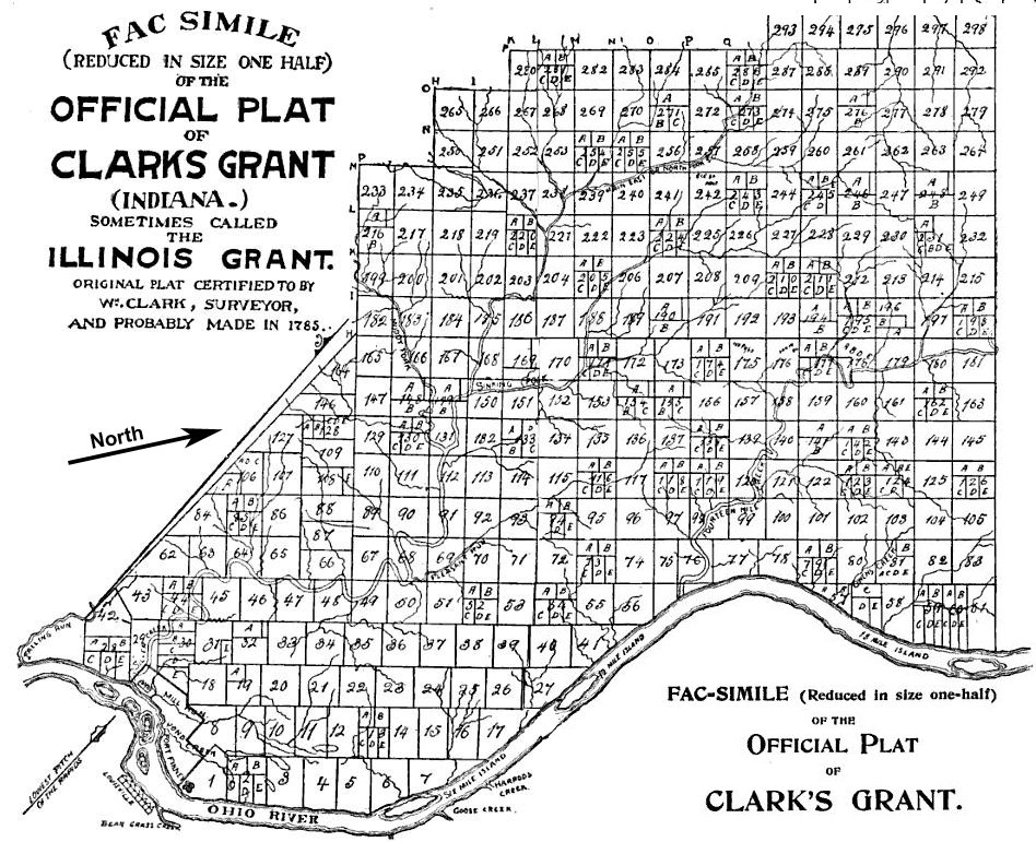
Map: William Hayden – English, William Hayden (©1896). Conquest of the Country Northwest of the River Ohio, 1778–1783, and Life of Gen. George Rogers Clark. Indianapolis: Bowen-Merrill., pages 852, 853 Public Domain.
Land granted by the state of Virginia on January 2, 1781 to George Rogers Clark and the soldiers who fought with him during the American Revolutionary War, became the first authorized settlement in the present-day Indiana. Clark’s Grant contained over 150,000 acres and was located in present-day Clark County, Indiana and parts of the surrounding counties.
Clark’s Grant sat across the river from Louisville, Kentucky on the northwest side of the Ohio River. Clark was certainly familiar with this area before the grant. During the Revolutionary War, he built a post on an island in the Ohio River to train Revolutionary War soldiers from the Virginia militia. He led them in capturing a large part of the Illinois Country as part of the Illinois Campaign. The captured land, which included most of present-day Indiana became Illinois County, Virginia.
There was little cash to pay men to fight the Revolutionary War. Land was offered as an incentive to get recruits to sign up as soldiers. After the war ended, Virginia granted the soldiers and officers land to compensate them for their service in their militia as did other states and the federal government.