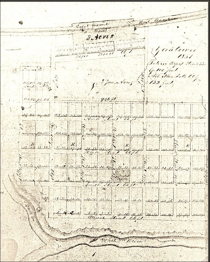
This map shows the plat of Yorktown, Indiana with the river flowing north, along the edge of the town. In the 1890’s, a large flood changed the course of the river. The river moved its course north of the town, following a horseracing track that was dug, sod removed, sometime earlier in our history. Buck Creek followed the old course of the river to its new confluence of White River.
The description from A Comprehensive Look at the People and History of Delaware County, Indiana, W.P.A. 1935 locates the track on the north side of the river. White River now flows along the edge of the current Morrow’s Meadow. Becky Sears Monroe noted that some of the property descriptions along Canal Street name the edge of the property as the middle of the White River. That water course is now filled by Buck Creek.